
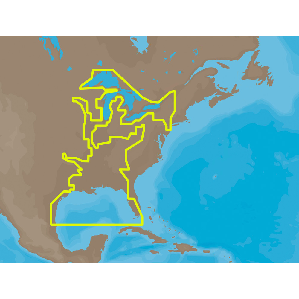
NA-M023 => Gulf of Mexico, Great Lakes and Rivers
Coverage of the Gulf states, starting from Boca Raton, FL, down to Key West, FL, then back up and around the Gulf to Brownsville, TX. Also includes coverage of all the Great Lakes: Erie, Superior, Ontario, Huron and Michigan. Coverage of the Great Lakes also includes Fox River and Lake Winnebago, Lake St. Clair and the Trent-Severn Waterway. River coverage includes the Mississippi River, Ohio River, Illinois River, Arkansas River, Red River, Ouachita River, Tennessee River, Cumberland River, Tenn-Tom Waterway and the Black Warrior River. Other smaller rivers are also included: Green River, KY, Kanawha River, WV, Allegheny and Monongahela Rivers, PA and Kankakee River, IL. Additional coverage of the Hudson River, including Lake Champlain, down to New York City, the Erie Barge Canal and partial coverage of the St. Lawrence River up to Montreal.This product may not be returned to the original point of purchase. Please contact the manufacturer directly with any issues or concerns.
Manufacturer : C-MAP
Manufacturer Part No : NA-M023SDCARD
| Weight | 0.10 lbs |
|---|---|
| Dimensions | 10.00 × 6.00 × 1.00 in |
| Brand | C-MAP |
| MPN | NA-M023SDCARD |
C-MAP cartography products and services include multiple formats for lakes, coasts, and oceans across the globe. With detailed coverage of over 8,000 lakes in the USA alone and over 7.2 million points of interest globally, C-MAP continues to invest in improving the coverage and quality of detail shown.


Reviews
There are no reviews yet.