
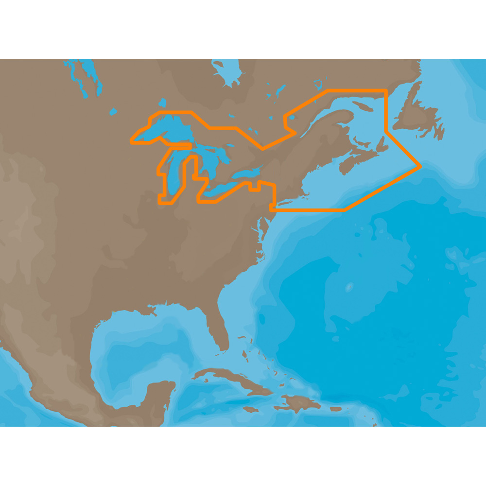
NA-M026 => Great Lakes, Northeast Coast and Approaches
Coverage of the Great Lakes, St. Lawrence River and Northeast United States. Coverage of the Great Lakes also includes Fox River and Lake Winnebago, Lake St. Clair, Rideau Canal, Ottawa River and the Trent-Severn Waterway. Includes all coastal charts for New Brunswick and Nova Scotia in Canada and Maine, New Hampshire, Massachusetts, Connecticut and New York in the U.S. Also included is coverage of the Hudson River and Lake Champlain as well as the Erie Barge Canal.This product may not be returned to the original point of purchase. Please contact the manufacturer directly with any issues or concerns.
Manufacturer : C-MAP
Manufacturer Part No : NA-M026SDCARD
| Weight | 0.10 lbs |
|---|---|
| Dimensions | 10.00 × 6.00 × 1.00 in |
| Brand | C-MAP |
| MPN | NA-M026SDCARD |
C-MAP cartography products and services include multiple formats for lakes, coasts, and oceans across the globe. With detailed coverage of over 8,000 lakes in the USA alone and over 7.2 million points of interest globally, C-MAP continues to invest in improving the coverage and quality of detail shown.


Reviews
There are no reviews yet.